Investigation of the Hayley Ann Sinking
Version:  A-1.00.00

Page 1 of 17
Hayley Ann Sinking

The following report is a compilation of information from several sources.

At 12:23 PM on Thursday ,January 23rd, 2020, the United Sates Coast Guard received a distress signal from the Hayley Ann’s emergency locator beacon. At the time, the vessel was about 45 nautical miles southeast of Portland, Maine. The Coast Guard sent a fixed-wing aircraft and two helicopters from Air Station Cape Cod to search for the boat. The Coast Guard cutter Steelhead also responded.

An air rescue crew in a fixed-wing plane first spotted the fishing boat as it sank, along with an empty life raft floating nearby. About 20 minutes later, the crew of a rescue helicopter arrived and saw two people in the water. The helicopter lowered a rescue swimmer into the ocean. The swimmer confirmed that the raft was empty and that two people in the water were unresponsive. About 4:30 PM, the Coast Guard tweeted, “The fishing vessel Ella Christine arrived on scene to assist in the recovery of the two persons.”

Arnold “Joe” Nickerson IV, a 60-year-old fisherman from Arundel, and 44-year-old crew member Chris Pinkham of Boothbay Harbor died when Nickerson’s 42-foot boat sank, according to the Maine Marine Patrol.

While the cause of the sinking is still under investigation, seas in the area at the time of the distress call were reported to be 5 to 8 feet.

It should be noted that this photo of the Hayley Ann was taken before it was converted from a lobster boat to a fishing trawler with the addition to the stern of a reel, net and associated equipment.

Cross References

  • FISHERYNATION Article: http://fisherynation.com/archives/tag/f-v-haley-ann
  • Portland Press Herald Article: https://www.pressherald.com/2020/01/23/coast-guard-searching-for-fishing-vessel-off-portland/
  • Investigation of the Hayley Ann Sinking
    Version:  A-1.00.00

    Page 2 of 17
    NOAA Report

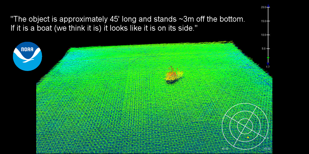
    The probable location of the Hayley Ann was identified during a multibeam sonar survey by the Ferdinand Hassler, a coastal mapping vessel for the National Oceanographic and Atmospheric Administration (NOAA). The sonar image provided strong evidence of a vessel on the bottom in the vicinity of where the Hayley Ann went down.

    This excerpt is from an email to the USCG by Colleen Roche P.E., NOAA, dated March 9, 2020:

    The Ferdinand Hassler has been collecting Multibeam data in the survey area. We have found several features but one stands out. It appears to be a 45' vessel in ~201m of water [and] was discovered at:

    43°09'05.216N, 069°18'19.055W

    The object is app. 45' long and stands ~3m off the bottom. If it is a boat (we think it is) it looks like it is on it's side.

    For those not familiar with sonar image interpretation, a sketch of the vessel has been superimposed over the image to help visualize how the wreck might look in actuality.

    Investigation of the Hayley Ann Sinking
    Version:  A-1.00.00

    Page 3 of 17
    Wreck Location

    This Google Maps image shows the position of the probable location of the Hayley Ann based on the NOAA survey.

    Investigation of the Hayley Ann Sinking
    Version:  A-1.00.00

    Page 4 of 17
    Mission

    In June, 2020, the USCG Sector Northern New England, USCG MSST Cape Cod and VideoRay planned an ROV dive to the Hayley Ann to investigate the condition of the wreck and to look for clues about what might have led to its sinking.

    The crew included:

    • USCG Sector Northern New England

    • USCG MSST Cape Cod
      • Jesse
      • Matt

    • VideoRay
      • Chris Gibson
      • Tom Glebas

    Investigation of the Hayley Ann Sinking
    Version:  A-1.00.00

    Page 5 of 17
    Equipment

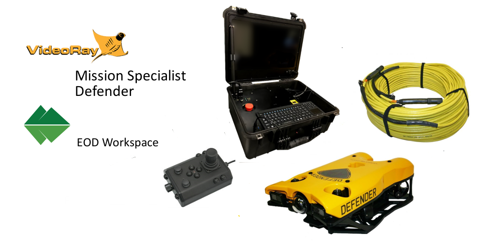
    The ROV selected for the mission was the VideoRay Mission Specialist Defender, which includes an HD camera and LED lights, forward looking multibeam sonar, a manipulator, and for navigation support, an ROV mounted GPS antenna, Doppler Velocity Log (DVL) and Ultra Short Baseline (USBL) acoustic position tracking system. The navigation package provides not only location information, but autonomous control capabilities. Greensea's EOD Workspace control software was installed on the Operator Control Console. Over 2,000 feet of tether was included in the load-out for this mission.

    USCG MSST Cape Cod brought their VideoRay Pro 4 system as a backup.

    Cross References

  • VideoRay Mission Specialist Defender: https://www.videoray.com/rovs/mss-rov/mission-specialist-defender.html
  • VideoRay Pro 4: https://www.videoray.com/rovs/videoray-pro-4.html
  • Investigation of the Hayley Ann Sinking
    Version:  A-1.00.00

    Page 6 of 17
    USCGC Sitkinak

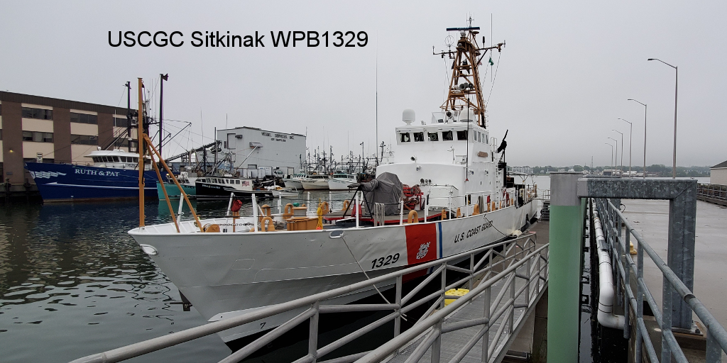
    The investigation was planned for June 30, 2020, aboard the USCGC Sitkinak, operating out of at Portland, Maine. The Sitkinak is a 110-foot Island Class Patrol Boat with a travel time to the destination of about 3 hours. The weather was heavy overcast with misty rain and winds from the NE at 10-12 miles per hour. Sea conditions were reported to be 2-3 feet in the vicinity of the sinking.

    As you can see in this file photo, Sitkinak was outfitted with a canopy over the fantail which provided some cover over the location chosen for the ROV operating station.

    After arriving on-site, a work safety assessment was conducted by the Executive Officer (XO) of the Sitkinak, and the ROV was set up and made ready for deployment.

    Investigation of the Hayley Ann Sinking
    Version:  A-1.00.00

    Page 7 of 17
    Dive 1

    Sometimes, it's easy to overthink things. The first dive was unfortunately a victim of such folly....

    The Sitkinak does not have any Dynamic Positioning capabilities and is engineered to idle at 9 knots. This presents a challenge for the coxswain to hold station over the dive site. It was decided to face the Sitkinak into the wind and "punch" the throttle only as much as needed to maintain heading and position. It was assumed that this meant the Sitkinak would slowly creep forward, so the starting point would be downwind of the dive site. With that in mind, the tether length was kept to a minimum and the plan was to deploy the Defender downwind of the site with the hope that it could be maneuvered over the site as it followed (or was pulled by) the Sitkinak into the wind.

    This strategy ended when the Defender could not dive below about 650 feet and never made it to the bottom. There were a few flashes of the bottom on sonar, but only briefly and not enough to conduct a reasonable search.

    In the meantime the Sitkinak got a little sideways to the wind and ended up drifting South of the site. The caused the tether to go under the stern and towards the port side. Fearing the worst for the tether, the screws were kept still and the ship went dead in the water. To make matters worse, this orientation and the wind's direction funneled the ship's exhaust directly towards the ROV operation station. With the ship broadside to the wind and seas, the roll increased significantly requiring someone to hold the control panel in place. Fortunately there were enough hands on deck that people could rotate out briefly to get fresh air.

    The only option at this point was to recover the Defender and regroup for another attempt.

    Investigation of the Hayley Ann Sinking
    Version:  A-1.00.00

    Page 8 of 17
    Dive 2

    Planning for the second dive was much more pragmatic - use longer tether, deploy directly over the site, dive quickly and hope to get enough bottom time before the Sitkinak creeps too far forward.

    This strategy worked and it wasn't long before finding something interesting on sonar.

    Investigation of the Hayley Ann Sinking
    Version:  A-1.00.00

    Page 9 of 17
    First Sonar Encounter

    [ This page contains a video when viewed online. This image is a preview. ]

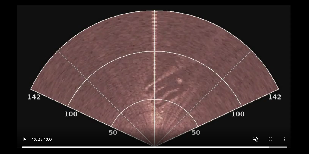
    This sonar clip from the second dive shows the first encounter with something of interest on the seabed. It was almost immediately obvious that it was not a vessel, but it was also not clear what is was. You can see several lines in the lower right at about the 50 feet range. The Defender was directed toward this location for a closer look. On continued observation and after zooming in to see more details, it was interpreted as three gouge marks or trenches, with the dark areas being the valleys and the bright areas being the ridges. Within the central area of the formation, there as a bright sonar target the seemed to be elevated from the rest of the surrounding area. While it was not the vessel of interest, it was determined worthy of further investigation.

    Investigation of the Hayley Ann Sinking
    Version:  A-1.00.00

    Page 10 of 17
    Piece of Netting

    [ This page contains a video when viewed online. This image is a preview. ]

    On visual inspection, the target of interest was identified as a section of netting. Given the proximity to the wreck site and the relatively clean, fresh state of the netting, it was surmised to be from the Hayley Ann. It was time to widen the search area...

    Before we move on, you might have noticed that when the vehicle is stationary, the particles suspended in the water are generally not flowing in any direction. This is an indication that the current is very minimal at this location and depth. If you didn't notice, you can replay the video to observe this.

    Investigation of the Hayley Ann Sinking
    Version:  A-1.00.00

    Page 11 of 17
    Dredge Line

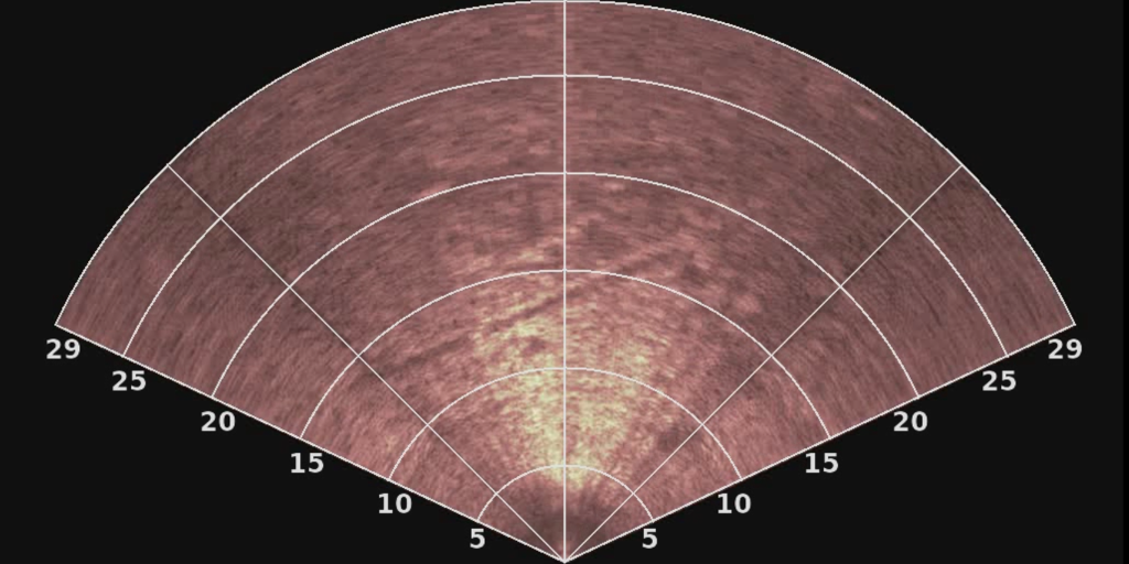
    While expanding the search in a circular pattern around the trenches and the netting, a dredge line in the sand was observed on the sonar display. You can clearly see it here. Several attempts to find the dredge line visually failed and it was decided to follow the line using the sonar as the guide and determining the bearing of the dredge line in the direction away from the trenches.

    Investigation of the Hayley Ann Sinking
    Version:  A-1.00.00

    Page 12 of 17
    Sonar of Vessel

    [ This page contains a video when viewed online. This image is a preview. ]

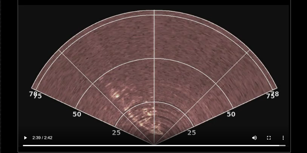
    In this sonar clip, you can see the discovery of a vessel. It first appears slightly left of center at about 150 feet of range. As the Defender progresses towards it you can make out the shape of the bow being approached from the starboard side. Once in closer, and with the sonar zoomed in, you can made out the hull lines clearly and see some of the details on the deck. You can also see additional gouged trench lines in the sand ahead of the vessel.

    Investigation of the Hayley Ann Sinking
    Version:  A-1.00.00

    Page 13 of 17
    More Gouge Lines

    Gouge line trenches, similar to the ones observed at the first indication of the wreck site, can be seen in this sonar image. It appears the vessel hit the bottom stern first at a fairly low angle. It impacted the bottom at the first location, and then traveled here to sit in its final resting place . The parallel gouge lines seem to be created by the stern and the trawl doors. This location is approximately 200 feet from the initial impact site and the depth at both locations is within a few feet of each other with flat, sandy bottom in-between.

    Investigation of the Hayley Ann Sinking
    Version:  A-1.00.00

    Page 14 of 17
    Video Confirmation

    [ This page contains a video when viewed online. This image is a preview. ]

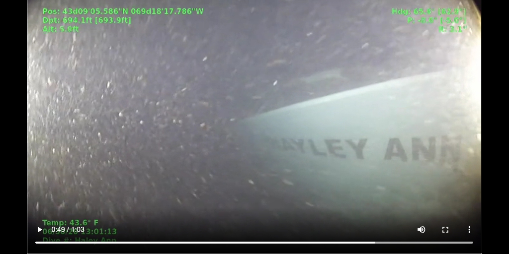
    In this video clip, the vessel is confirmed as the Hayley Ann. The clip ends as the Defender moves aft toward the stern for an inspection of the trawling equipment.

    The Defender's depth plus altitude as seen in the video overlay indicate the depth to the sea floor is almost exactly 700 feet, which is slightly deeper than the NOAA estimate.

    Investigation of the Hayley Ann Sinking
    Version:  A-1.00.00

    Page 15 of 17
    Reel and Net

    [ This page contains a video when viewed online. This image is a preview. ]

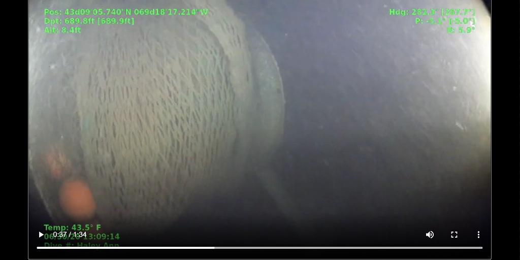
    Having confirmed the identity, the mission shifted from searching mode to investigation. The Defender was navigated towards the stern. There were no signs of structural damage on the starboard side and the starboard trawl door was observed to be in the stowed position. Bringing the Defender around to approach the stern head-on, the net was observed to be fully stowed on the reel, and the port trawl door was also found to be in the stowed position.

    This confirms that the Hayley Ann was not configured for trawling operations at the time of its sinking.

    Upon acknowledgment from the Coast Guard investigation team that we had collected enough information to complete their analysis, we departed the scene leaving the Hayley Ann alone in the darkness.

    Investigation of the Hayley Ann Sinking
    Version:  A-1.00.00

    Page 16 of 17
    Preliminary Findings

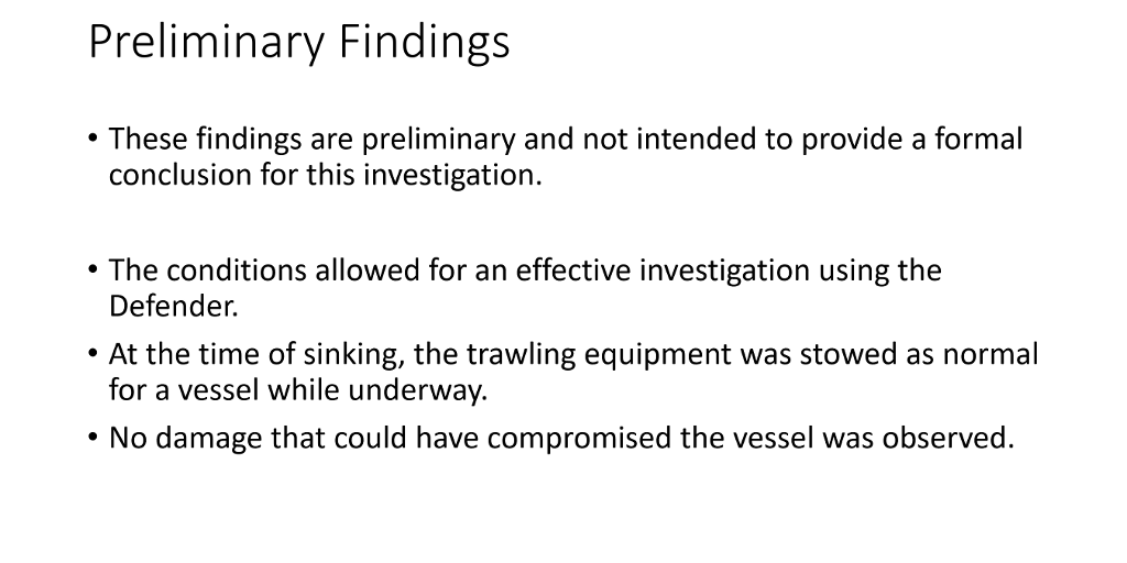
    While the USCG will carefully review the data collected in more detail before issuing a final report, some general comments can be made at this time.

    • First, the water was clear enough and the Defender was able to reach the site and get close enough to achieve good visual acuity of the wreck for a thorough inspection.

    • At the time of the sinking, the vessel was configured with the trawling equipment stowed in what looked like the proper configuration for a vessel underway.

    • There were no observations of any damage that might have compromised the seaworthiness of the vessel or that would contribute to its sinking.

    Investigation of the Hayley Ann Sinking
    Version:  A-1.00.00

    Page 17 of 17
    Lessons Learned

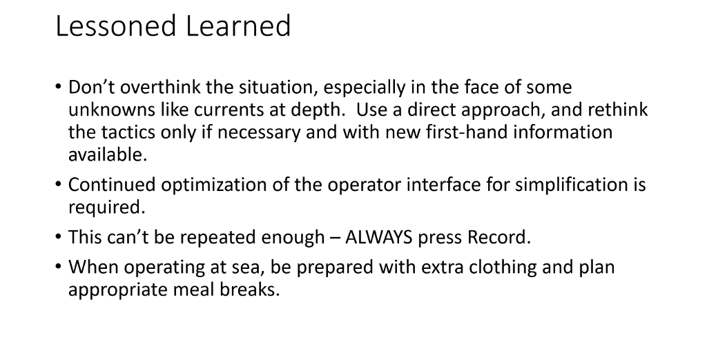
    The following thoughts are presented in the interest of improving future operations.

    • Develop the dive plan based on known information. Don't overthink the situation and don't try to accommodate too much speculative information in the planning.
      • Go with the most direct approach first and if that fails, then reconsider with better knowledge of the conditions. For example, the current was not known. If there had been a significant current, that might affect the deployment location relative to the site. But, without knowing that in advance, it is best to just assume it will not be a factor.
      • Start with more tether than needed, unless it exceeds the recommended limit or adversely effects ROV power. It doesn't all have to be deployed.

    • The feature rich interface can be challenging to operate and maintain focus on each aspect of piloting and sensor control. An operations checklist of items to monitor or set, and a second set of hands can be helpful.

    • While it was not an issue during this operation, it can never be said enough and is worth repeating, ALWAYS make sure to record.

    • ALWAYS over pack clothing when going out to sea and no matter what the forecast may be, expect foul weather. We did not have enough warm clothing or protective outerwear for wet weather.

    • Plan meals within the operational timeframe. While we brought some snack food, we didn't get the chance to eat breakfast or lunch.